El Camino del Diablo – Dec 2020

Dates: December 8-9, 2020

Vehicle: 2020 Jeep Wrangler JK, Rubicon, stock

Permit: iSportsman via https://luke.isportsman.net

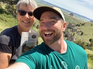
Resource: A Visitor’s Guide to El Camino del Diablo (2016)

I primarily used this resource as it could be downloaded and used offline. It was a bit convoluted to follow, but once you figure out the paging it was invaluable. I found this as a .pdf at Sierraclub.org

Overnight accomodations

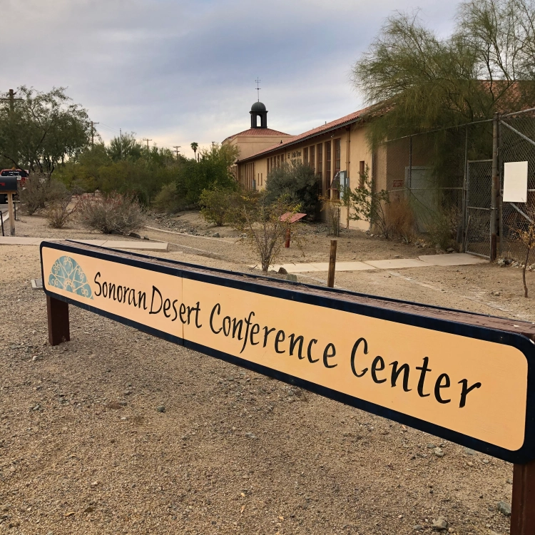
Ajo – Sonoran Desert Inn & Conference Center, highly recommended

http://www.sonorancc.com

Yuma – national motel chain 

Route:

Day 1 – Ajo to Tule Well to Wellton

Day 2 – Yuma to Tinajas Altas to Tule Well to Tacna

Day 1

  The night before we arrived in Ajo and checked into the Sonoran Desert Inn & Conference Center, a delightful place to stay. This is operated as a non-profit, in a refurbished elementary school. The rooms are very comfortable and spacious. After a comfortable night we drove out of Ajo east to Darby Well Road to start the first part of our trip, starting a bit after 9 AM. 

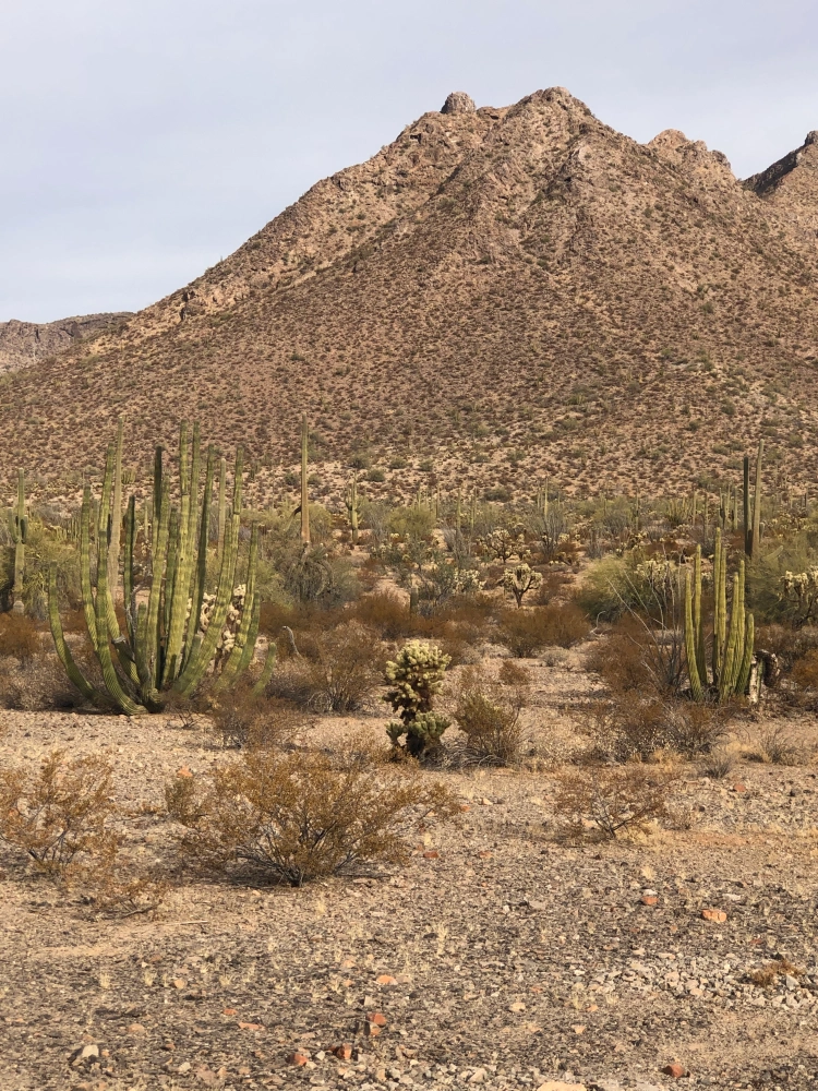
   After driving through the Bureau of Land Management area, which allows dispersed camping, we entered the Organ Pipe Cactus National Monument. We did see a few of the iconic Organ Pipe cactus, mainly along slopes to the east. We bypassed Bates Well, we had spent time there last Spring. Well worth a stop and time spent exploring the structures. 

   The road so far was well-graded and suitable for any 2 WD, as it remains up to the Cabeza Prieta National Wildlife Refuge (NWR) entrance. At the entrance sign is a sign-in stand which has permits to record your trip details, this is in addition to the permit you must secure online before starting the trip. That permit is a print out which is to remain on your dashboard and provides a permit number used for the permits (one per person) at the NWR entrance. The permit at the East entrance was more detailed than the one we completed the next day at the West entrance.

  Once on the refuge the road became narrower, but still 2 WD. It wasn’t until we entered Las Playas, at mile 47 (from Darby Well Rd & AZ 85) that sand became deeper and 4 WD recommended. After any rain this section could be impassable, check with NWR staff before starting the route. A few days before they confirmed via e-mail the route was in good shape and passable in this area. The guide mentions the use of metal landing mats, we saw these off to the side of the road, never in the roadway. Shortly we entered the Pinacate Lava Flow, rough rocks, but nothing difficult to traverse, just slow down. 

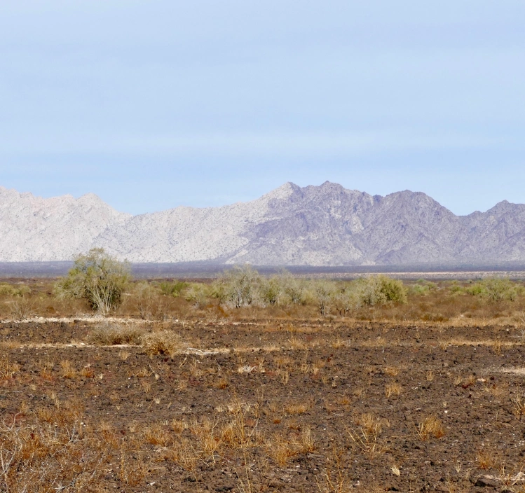
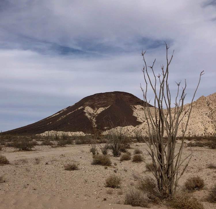
  Near mile 50, looking Northwest you notice a mountain range where a light section meets a dark section, the Sierra Pinta.  This is a geologic example of horst and graben, a fault line displaying one block up, one block down. The surrounding area also has some dramatic lava peaks. We stopped for lunch in a wash near mile 63.8. We had hoped to see bighorn sheep in the surrounding hills, but no luck.  

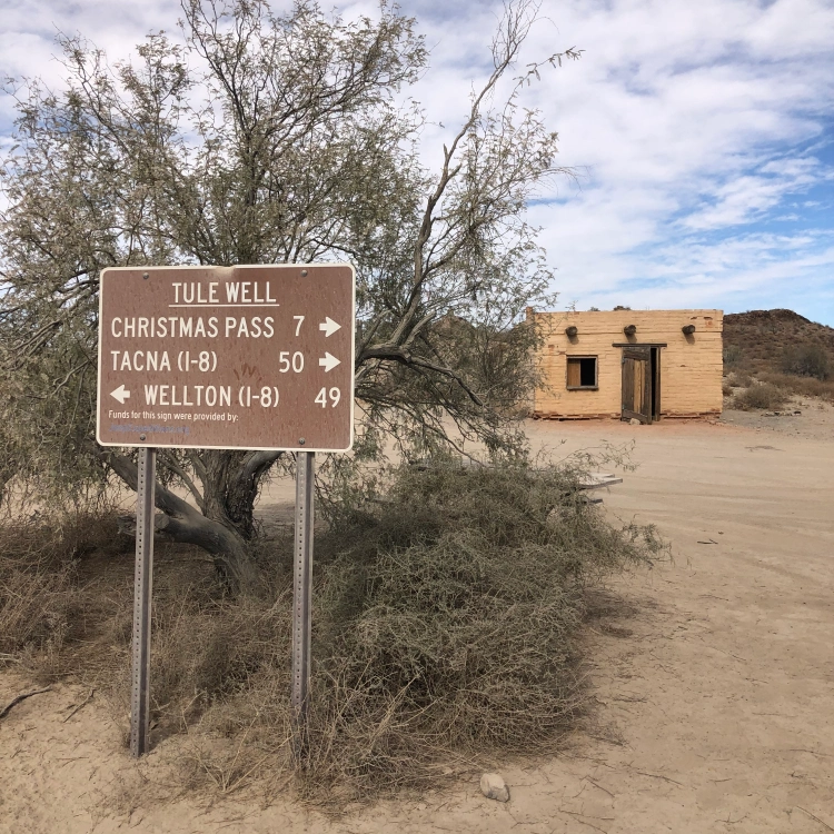
   At mile 66.8 an administrative road came in from the southeast and the road doubled in width and smoothed out. No research prepared us for this, a construction road for the Border Wall. Along with the new road came lots of large trucks and other vehicles. This continued all the way into Wellton and I-8. We stopped briefly at Tule Well to see the cabin built in 1989 by the military to commemorate the 50th anniversary of the NWR. Further along was a nice view of Tordillo Mountain.

   As we headed northwest to I-8 and left the Goldwater Military Range this sign gave the best history of El Camino del Diablo. We ended the day in Yuma, staying overnight in a motel. 

Day 2

   Starting from Yuma we went south on Foothills Blvd, entering the Western section of the Goldwater Military Range. Prior to starting I used the Visitor Guide to reverse the mileage, as the guide is written from east to west. We stayed along the pole line road, not taking the side trip to the Fortuna Mine, we’ll do that at another time. 

   After a straight shot south we turned east and began heading towards mountains. All along the southern edge of the road were signs warning us of unexploded ordnance. The best views were to the north, passing rugged hills of solid rock.

    Along this stretch we saw one stationary mobile Border Patrol truck, but no other vehicles till we reached the other side of Tinajas Altas. Wooden posts mark the way, acting as confidence markers at various intersections, as well as a few small brown signs identifying El Camino del Diablo. The only question we had was at A13, but stopping and checking the guide kept us on the best path. Along this stretch there were quite a few sandy wash crossing, more washboard than yesterday and maybe one place where high-clearance was needed. The drive approaching Tinajas Altas was interesting as you couldn’t figure out where you were headed. Once at the pass we were surprised at how wide the area was between mountains on each side. It was a nice place to take a break after about 2 hours of driving.  

   East of here we quickly reached the wide construction road which took us back to Tule Well. We stopped here for quick bite of lunch before heading north to Christmas Pass.

This route was popular over a century ago, considered to be the quickest route to reliable water along the Gila River. After driving the route I can’t imagine how they kept supplied with water along the way.  This was a beautiful section, heading through some mining claims and shapely hills. You pass remains of camp from the 1940’s. Dan Drift lived out here and fashioned the road at Christmas Pass so he could get to Wellton for supplies. The next 2 miles were where 4 WD and high clearance were necessary. We saw no one else along this section until we turned the corner at Christmas Pass and saw a group of 5 OHVs and their riders enjoying lunch at the campground. 

  From here the road was a narrow wash bed that headed north to I-8, about 37 miles. As you approached the Mohawk Dunes at mile 30 the road became wide and more solid. The views along the drive were primarily of mountains in the distance and large expanses of creosote bushes roadside. One place worth stopping was for a very large Ironwood tree, I can only imagine how beautiful it would be when blooming in the spring. 

 The sand was never a concern for driving, in fact you still felt the washboard beneath. The guide book indicated you would turn left near mile 40 to head back west before reaching the on ramp for I-8. We missed that turn and literally came up to an open gate at the shoulder of I-8. As we were heading east, back to Tucson, we carefully entered I-8 there, no signs were present to indicate no entry or exit. 

   Overall the trip was excellent, two days of mid-70 degrees and no wind made for the best weather possible to enjoy the route. As other write ups reveal there are a number of sights along the way to stop and explore. As this was our first time having a vehicle we felt comfortable driving the routes we wanted to see what was there and where we would spend more time in the future. 

   A great place to practice physical distancing during the covid pandemic. Overall we probably saw 5 Border Patrol vehicles, 2 helicopters, maybe 3 other private vehicles, the OHV group and numerous construction vehicles. Before reaching the Las Playas a Border Patrol agent chatted with us while we were out of the car exploring O’Neill’s gravesite. He warned us they were tracking 8 migrants further up the road, that is where we saw 2 helicopters close to the ground flying in tight circles. It was well north of the road and didn’t affect our route. The only surprise of the trip was the developed construction road right in the middle of El Camino del Diablo. 

   We accomplished our goal of driving the different routes and are looking forward to return trips in the future.  

City of Rocks National Preserve – Idaho

City of Rocks National Reserve
Idaho

https://www.nps.gov/ciro/index.htm

Junior Ranger – Senior Friendly

Completed: April 14, 2020

After six visits from 1998 through October 2019 to City of Rocks National Preserve, I finally finished their Junior Ranger booklet in April 2020, while staying home during the covid-19 pandemic. While organizing my junior ranger files I found the almost completed booklet. Luckily anything I needed to do while onsite I had completed, I just needed to finalize a few pages.

This park site is in the southern section of Idaho and is managed in conjunction with Idaho State Parks and Recreation. On previous visits we have camped within the preserve at NPS campgrounds and state park campgrounds. The beauty of this park can be experienced by camping or just on a day trip. I love the rocks; the variety of shapes, composition and groupings. The Native American history, as well as the California Trail route adds to the visit.

The program is considered Senior Friendly as the booklet is designed for ages 10 & up. There are thirteen activities, and seven are to be completed to earn the Junior Ranger badge. I completed ten activities, and partially did a couple of others. There is a nice mix between geology, natural features, history, map skills and art activities.

Rocky Scavenger Hunt provided excellent background on nine different geologic properties found in the preserve and an activity to match pictures to the terms. Matching animal characteristics, as well as animal tracts were done in the Who Am I? and Name that Track activity. The Map Search page made me realize there is more for me explore on my next trip to City of Rocks Preserve.

After contacting the staff by email I was told to take photos of my completed pages and email them to a designated ranger. I received positive feedback about my work and within a week I received their attractive wooden, enhanced badge.

Scotts Bluff National Monument – Nebraska


Scotts Bluff National Monument
Nebraska

https://www.nps.gov/scbl/index.htm

Completed:June 25, 2019

The best experiences are unplanned. As we were driving towards Scotts Bluff National Monument I saw on my Instagram feed that a fellow Senior/Junior Ranger, and one I had not met in person, was also on his way to Scotts Bluff NM. I made contact with @cliftonwanders, Patrick, and agreed to meet in the picnic area. Once we met we headed off to the visitor center to pick up our Junior Ranger booklets.

The visitor center was closed for renovation, a temporary trailer was onsite for passport stamps, gift shop and ranger contact. We learned that we only needed to hike a trail at Bluff Summit and answer questions related to the trails we hiked.


We drove up to the top and walked the South and North Overlook Trails. Seems like we backtracked a bit to find the places that would yield the answers to the questions posed in the booklet. I think our non-stop talking about our travels and common interests may have interfered with a more organized path. Overall it was a great experience, so fun to share a park experience with another fanatic!

Not rated as Junior Ranger, Senior Friendly as the booklet indicates the program is designed for ages 6 through 12. However, the staff was welcoming for these junior/seniors to complete the program. The requirements may be different depending on access to the visitor center. Upon return to the visitor center the ranger on duty administered the oath and issued us the wooden badge which highlighted the 100th anniversary of this site.

Photo Credits: @cliftonwanders, except for booklet. Thank you for commemorating this visit!

Colorado National Monument – Colorado

Colorado National Monument
Colorado

https://www.nps.gov/colm/index.htm

Junior Ranger – Senior Friendly

Completed: June 30, 2019

A great place to explore, by car or foot. This site may not be on everyone’s list to visit, I would move it up and make sure to visit next time you are in the area. One thing we have realized over the past few years is Grand Junction, CO is close to Moab, UT which has better known park sites. The access to camping and lower cost lodging is much better in Grand Junction, and only a 2 hour drive away. During the busiest season rooms and campsites may not be available or too expensive in Moab, consider staying in Grand Junction and enjoying Colorado National Monument while in the area.


When I visited we were traveling through the park from West to East, with a stop at the visitor center near the beginning of the visit. When I picked up the booklet I asked if I could mail in the completed booklet after our visit, I was told that was acceptable. When planning to visit you can also print out a booklet in advance, the current link is listed below.

This program is considered Senior Friendly, the oldest age category is listed as Over 10. Other age groupings are 7 & under and 8-10 years old. For the older crowd at least 7 activities with eleven possible are to be completed. Besides completing the activities in the booklet you are expected to take a hike or attend a ranger program.

I took a delightful, short hike from the visitor center on a hot day along the Alcove Trail. I spent time photographing the view, tiny flowers, cryptobiotic soil, a lizard and a prehistoric-looking crane fly. A short trail, which allowed me to focus on the views and critters along the way.

Activities in the book included;
Explore – Trail Report, Learn – Be a Geologist, Learn – The Wear-Away Forces, Learn – Wild Ways, Learn – Living Soils, Explore – Meet the Plants, Learn – Otto’s Dream, Learn – Living off the Land, and Protect this Land Forever. Several activities focused on geology, a main theme of this park. Learning about the through John Otto’s Dream was enlightening. The focus on biology through Meet the Plants and Living Soil was the most interesting for me. Overall the booklet is well designed and was enjoyable to complete.

I finished up some of the drawing activities after I got home from the trip and mailed it to the address on their website. My booklet was returned with the standard Junior Ranger badge aling with a congratulatory letter from Ranger Abby. I really appreciated the persoal comme ts she added to the booklet.


Download the Activity Guide;

Click to access Activity-Guide.pdf

Junior Arizona Archeologist – 18 Arizona NPS sites

Navajo National Monument Archaeology
Navajo National Monument – Betatakin Ruin

Junior Arizona Archeologists
18 Arizona NPS sites

Click to access Junior-AZ-Arch-2016-as-published.pdf

Junior Ranger – Senior Friendly

Completed: October 18, 2018

In 2016 the Southern Arizona National Parks Office and Western National Parks Association created a statewide junior ranger program highlighting archeology throughout Arizona. The Oxford dictionary defines archeology as “the study of human history and prehistory through the excavation of sites and the analysis of artifacts and other physical remains“. Without a doubt the Arizona sites provide a wealth of experiences to explore the state’s rich archeological history.

Organ Pipe Cactus NM - Archaeology
Organ Pipe Cactus National Monument – Victoria Mine

Eighteen of the twenty-two NPS Arizona sites are included in this program. To earn the patch only four sites have to be visited. A site specific ‘rocker’ patch was initially available for all of the sites. By the time I finished it in 2018 several sites had run out of their patch. I was able to get 12 of the 18 ‘rocker’ patches. Every site I visited was friendly to this Senior.

Each site has two pages to complete, one to be done on site and another page that can be done before you arrive. To be honest I found some of these on site activities to be the hardest I have ever done. Matching the picture in the booklet with the items on display in the visitor center was a challenge. The mixture of photo identification with answering questions was a great way to learn about the site’s archeology.

Montezuma Castle NM Archaeology
Montezuma Castle National Monument

I never tire of visiting the many Arizona National Park Services sites. Having this statewide program focused on archeology provided a fun experience.

Arizona Explorer Junior Ranger


Arizona Explorer

22 Arizona NPS sites

Completed: November 20, 2018

Junior Ranger – Senior Friendly

Online;

Click to access az-explorer.pdf

Explore Arizona and earn a patch! With twenty-two National Park Service sites scattered across the state this program provides a variety of experiences. Western National Parks Association along with the National Park Service Southern Arizona Office created a state-wide Junior Ranger program. All of the sites were welcoming of this Senior Ranger.

With only four site visits and 7 pages of activities you can earn the attractive patch, with a visit to any of the sites you can earn the small site-specific ‘rocker’ patch. I was determined to visit all of the sites and get all of the rockers! Over seven months I made it to all of the sites, but the final site, Grand Canyon – Parashant National Monument eluded me. We planned to visit the monument and complete the assignment, but the office staff in St. George, UT told us no rocker was made for this site.

Now, for the best part of this program – it is based on photography! At each site there is a specific Photo Challenge. Some of the challenges involved a hike, some were right at the park’s visitor center. Rather than detail the activities in the booklet, you can view them using the link above. Below are some of the Photo Challenges I completed.

Casa Grande National Monument – Hidden Room

Chiricahua National Monument – Volcanic Hoodoos

Grand Canyon National Park – Kaibab Formation

Montezuma Castle National Monument – Historic Diorama

Glen Canyon National Recreation Area – Lee’s Ferry Peach tree

Tonto National Monument – Salado Pottery

Tonto Salado

Coronado National Monument – International Border
This hike will also qualify for their ‘I Hike for Health’ pin

Booklet

As time goes on some sites may not have the ‘rocker’ patch for their site, however the Photo Challenge and learning about the park will make this program timeless. Get Outside and Explore Arizona!

African Burial Ground National Monument – New York

African Burial Ground National Monument
New York

http://www.nps.gov/afbg/index.htm

Senior Friendly

Completed: July 18, 2018

A relatively new site, it was added to the National Park Service in 2006. The story reaches back to the 17th and 18th century when African men, women and children were buried in lower Manhattan and then forgotten. In 1991 their graves were rediscovered when a new building site was being excavated. From there a series of events led to the development of this unique and well-interpreted site. Besides being in the center of New York City, on a summer day with local day camps visiting this site was lively. I appreciate how the park service has interpreted this difficult history. Possibly 20,000 individuals may have been buried in this 5 block area. Of those, 419 sets of remains were excavated and sent to Howard University in 1993. They were returned to the site in 2003 for reburial. The visitor center does an excellent job of explaining the history. Adjacent, but outside and around the corner, is a dramatic Memorial.

This Junior Ranger program is considered Senior Friendly as no upper age is given. Only 4 activities are required to be completed, with 10 different activities from which to chose.

Artifacts Pictures of artifacts found on this site with the names scrambled, to be unscrambled.

Language Using Senegal, one of the African languages spoken, a couple of sentences which included my name and where I am from was transcribe. A translation guide was provided.

Who Am I? Short description of individuals are provided, using information from the visitor center displays I identified them. The descriptions focused on the circumstances of their slavery and their determination to become free.

Symbols Several Andinkra symbols are shown with their meaning; Wisdom & Prudence, Hope, Guardinship and Patience & Tolerance. For this activity you draw your own symbol.


Be A Reporter Using the timeline in the visitor center nine events from 1991 up to 2010 are identified detailing the discovery of the remains, up to the opening of the visitor center.

Fill In The Blank Completing the 5 sentences from informations found in the visitor center.

Freedom For me – “Freedom to speak freely!”

Memorial Stepping outside the answer to these 7 questions are found at the Memorial.

Africa Color Africa your favorite color.

Experience Your America An opportunity to list the ways to care for all of the National Parks.

Even with lots of summer camps kids experiencing the site I was able to complete the booklet in about 1-1/2 hours. The space is small and packed with excellent displays and information. The ranger on duty willingly helped me with a few of the questions. Besides receiving the enhanced, smaller metal badge I received an attractive patch.

Next time you are in New York City take time to visit the African Burial Ground Monument, it literally is ‘history’ under your feet.

Waterton Lakes National Park – Alberta, CN


Fringed Grass of Parnassus

Waterton Lakes National Park
British Columbia, Canada

Completed: July 2017

Senior Friendly

As a park partnered with the US Glacier National Park and sharing an international border, Waterton Lakes is a site I have visited several times over the years. On a previous visit I was fortunate to travel south by boat on Upper Waterton Lake to visit Goat Haunt, on the northern edge of Glacier National Park. On this visit I explored more of the land-based sections of Waterton Lakes, getting some wonderful wildflower photos.

This program is considered Senior Friendly, as no age levels are given. No minimum activities are stated to become an Xplorer at this park. The activities include; Join In, Take It Easy, Figure It Out, Find It, Create Your Own, Take A Look, Get Moving, Take A Drive, Search For, Listen, and Imagine.

Join In: A quick journal entry about the evening program Plant Wars. This was an excellent program, lots of audience participation.

Take It Easy -Do Your Part: A checklist of five environmentally friendly things I did while visiting the park.

Figure It Out – Caution: Mother Nature at Work: check mark for visits to homes for plants and animals. I was able to see an avalanche which created Bertha Falls and a flood area at Cameron Creek.

Find It: A Bingo card featuring Flowers, Butterflies and Bees. I was able to find 7 of 9.

Get Moving – Four Seasons of Fun. Creating a bucket list of things to do during the season of your visit. Mine included to camp at Crandall Lake, visit the Native Plants Garden and take flower photos.


Harebell – Campanula rotundifolia

Listen – The Sounds Around: Create a chart listing natural sounds and human-made sounds. While visiting the park the natural sounds I heard were; rain, thunder, the chattering of a red squirrel, a bird singing and a rushing river.

At the end of the evening program, at the campground, I presented my completed booklet to Ranger Brenna and received the last of my awards from Parks Canada, on this trip. I think their Xplorers program was very well done. I enjoyed each park’s activities as I travelled through Canada in July 2017. I look forward to a return visit to Canada and completing more of their programs.

Kootenay National Park – British Columbia, Canada


Kootenay National Park
British Columbia, Canada

Completed: July 2017

Senior Friendly

Tucked into the Rocky Mountains, not far from the ‘rock stars’ of Jasper and Banff National Parks is Kootenay. After spending a couple days dodging the crowds of those parks I thoroughly enjoyed exploring this park. Shortly after entering from the eastside we stop at the roadside monument where the Great Divide Trail crosses the main highway through the park. This is a continuation of the Continental Divide Trail which is the US portion of a trail that connects the southern border of New Mexico to the northern border of Montana, and into Canada. It rained most of the afternoon and into the evening, limiting the opportunity to take landscape photos.

This program is considered Senior Friendly, as no age levels are given. Only five*activities are required to become an Xplorer. The activities include; check it Out, Create Your Own, Go Investigate, Join In, Figure it Out, Take A Walk, Try it Out, Take A Look, Go Play, Use Your Senses, Take it Easy, Go Meet, and Remember.

Check it Out – Your Destinations: While visiting I was able to go to Marble Canyon, Continental Divide, Vermillion Crossing, Olive Lake and the Kootenay

Try it Out – Haven off the Highway: while exploring Olive Lake I counted 14 bird sounds, which I identified as Baried Thrush.

Take A Look – Traveling Tracks: Matching six animals with their tracks.

Go Play- A Pathway to Paint: Using ochre (watercolor pencil) paint I ‘painted’ some animals seen in the park.

Use Your Senses – Natural Noise in the Park: Listing the natural and man-made sounds

Take it Easy – Natural Noises Word Scramble: From Tweet (wtete) to Growl, six animal sounds to unscramble

Remember -My Favourite Trip Tale: a short written memory about camping at Marble Canyon, experiencing an afternoon thunderstorm.

The next morning we enjoyed a delightful breakfast of fresh baked scones in the Kootenay Mountain Lodge at Vermillion Crossing before continuing west to Radium Hot Springs and the visitor center for the park. After reviewing my completed booklet the staff presented my with the dog-tag style award as a Parks Canada Xplorateurs. I guess I got the French language tag for this park.

*current web page indicates six activities

https://www.pc.gc.ca/en/pn-np/bc/kootenay/activ/interp

Glacier National Park -British Columbia, Canada

Glacier National Park
British Columbia, Canada

Completed: July 2017

Senior Friendly

In the heart of the Rocky Mountains is Canada’s Glacier National Park, just as spectacular as the one a bit further to the South and across the U.S. border. The glaciers, peaks and rushing rivers were magnificent! I was fortunate to be able to camp at Mount Sir Donald campground along the Illecillewaet River. Besides giving me some extra time to work on the Xplorers booklet I was able to explore along the river.


Dwarf Fireweed

Some of my favorite photos of the trip were taken here. Dwarf fireweed (Chamaenerion latifolium) was blooming in the riverbed, a gorgeous backdrop to Mount Sir Donald. Also while wandering along the riverbed I watched an American Dipper make trips between its nest, under the highway bridge and down to the river.


American Dipper

This program is considered Senior Friendly, as no age levels are given. Only three activities are required to become an Xplorer. The activities include; Find It, Take A Look, Go Investigate; Become a Tracker and The Scoop on Poop, Join In, Figure it Out, Find It, Use Your Senses, Get Moving, Try it Out, and Find It.

Completed Activities:
Find It – Bingo! I completed one full diagonal row to include Park Staff, Cedar, Mosquito and Red Squirrel, as well as Creek or river, Steller’s Jay, and Fireweed

Take A Look – Eye Spy Through The Park; some of sights I saw as we drove through the park includes; Canada Park, Trans-Canada Highway, Steller’s Jay, An avalanche path,Glacied National Park West Entrance sign,Waterfalls, The Rogers Pass Discovery Centre, The Robers Pass Summit Monument, Loop Brook Pillar, Train tracks, A Raven, and Mount Sir Donald (from our campsite).

Go Investigate – The Scoop on Poop! Matching seven animal’s scat description with the animal. I learned that bear scat floats because of all the wood they eat.

Figure It Out – Glacier’s Animals, a crossword puzzle based on the animals found throughout the park.

Find It – Scavenged Hunt; found a rock, moss, pine cons, fern (something alive), stump and (something dead).

Find It – Mountain Maze; follows a maze route through the Selkirk Mountains.

After a night of camping at Mount Sir Donald we stopped at The Rogers Pass Discovery Centre where my book was reviewed and I was given the dog-tag style for Glacier National Park.

https://www.pc.gc.ca/en/pn-np/bc/glacier/activ/~/media/46569C22CC844D3C9209C58D7CF31D81.ashx