El Camino del Diablo – Dec 2020

Dates: December 8-9, 2020

Vehicle: 2020 Jeep Wrangler JK, Rubicon, stock

Permit: iSportsman via https://luke.isportsman.net

Resource: A Visitor’s Guide to El Camino del Diablo (2016)

I primarily used this resource as it could be downloaded and used offline. It was a bit convoluted to follow, but once you figure out the paging it was invaluable. I found this as a .pdf at Sierraclub.org

Overnight accomodations

Ajo – Sonoran Desert Inn & Conference Center, highly recommended

http://www.sonorancc.com

Yuma – national motel chain 

Route:

Day 1 – Ajo to Tule Well to Wellton

Day 2 – Yuma to Tinajas Altas to Tule Well to Tacna

Day 1

  The night before we arrived in Ajo and checked into the Sonoran Desert Inn & Conference Center, a delightful place to stay. This is operated as a non-profit, in a refurbished elementary school. The rooms are very comfortable and spacious. After a comfortable night we drove out of Ajo east to Darby Well Road to start the first part of our trip, starting a bit after 9 AM. 

   After driving through the Bureau of Land Management area, which allows dispersed camping, we entered the Organ Pipe Cactus National Monument. We did see a few of the iconic Organ Pipe cactus, mainly along slopes to the east. We bypassed Bates Well, we had spent time there last Spring. Well worth a stop and time spent exploring the structures. 

   The road so far was well-graded and suitable for any 2 WD, as it remains up to the Cabeza Prieta National Wildlife Refuge (NWR) entrance. At the entrance sign is a sign-in stand which has permits to record your trip details, this is in addition to the permit you must secure online before starting the trip. That permit is a print out which is to remain on your dashboard and provides a permit number used for the permits (one per person) at the NWR entrance. The permit at the East entrance was more detailed than the one we completed the next day at the West entrance.

  Once on the refuge the road became narrower, but still 2 WD. It wasn’t until we entered Las Playas, at mile 47 (from Darby Well Rd & AZ 85) that sand became deeper and 4 WD recommended. After any rain this section could be impassable, check with NWR staff before starting the route. A few days before they confirmed via e-mail the route was in good shape and passable in this area. The guide mentions the use of metal landing mats, we saw these off to the side of the road, never in the roadway. Shortly we entered the Pinacate Lava Flow, rough rocks, but nothing difficult to traverse, just slow down. 

  Near mile 50, looking Northwest you notice a mountain range where a light section meets a dark section, the Sierra Pinta.  This is a geologic example of horst and graben, a fault line displaying one block up, one block down. The surrounding area also has some dramatic lava peaks. We stopped for lunch in a wash near mile 63.8. We had hoped to see bighorn sheep in the surrounding hills, but no luck.  

   At mile 66.8 an administrative road came in from the southeast and the road doubled in width and smoothed out. No research prepared us for this, a construction road for the Border Wall. Along with the new road came lots of large trucks and other vehicles. This continued all the way into Wellton and I-8. We stopped briefly at Tule Well to see the cabin built in 1989 by the military to commemorate the 50th anniversary of the NWR. Further along was a nice view of Tordillo Mountain.

   As we headed northwest to I-8 and left the Goldwater Military Range this sign gave the best history of El Camino del Diablo. We ended the day in Yuma, staying overnight in a motel. 

Day 2

   Starting from Yuma we went south on Foothills Blvd, entering the Western section of the Goldwater Military Range. Prior to starting I used the Visitor Guide to reverse the mileage, as the guide is written from east to west. We stayed along the pole line road, not taking the side trip to the Fortuna Mine, we’ll do that at another time. 

   After a straight shot south we turned east and began heading towards mountains. All along the southern edge of the road were signs warning us of unexploded ordnance. The best views were to the north, passing rugged hills of solid rock.

    Along this stretch we saw one stationary mobile Border Patrol truck, but no other vehicles till we reached the other side of Tinajas Altas. Wooden posts mark the way, acting as confidence markers at various intersections, as well as a few small brown signs identifying El Camino del Diablo. The only question we had was at A13, but stopping and checking the guide kept us on the best path. Along this stretch there were quite a few sandy wash crossing, more washboard than yesterday and maybe one place where high-clearance was needed. The drive approaching Tinajas Altas was interesting as you couldn’t figure out where you were headed. Once at the pass we were surprised at how wide the area was between mountains on each side. It was a nice place to take a break after about 2 hours of driving.  

   East of here we quickly reached the wide construction road which took us back to Tule Well. We stopped here for quick bite of lunch before heading north to Christmas Pass.

This route was popular over a century ago, considered to be the quickest route to reliable water along the Gila River. After driving the route I can’t imagine how they kept supplied with water along the way.  This was a beautiful section, heading through some mining claims and shapely hills. You pass remains of camp from the 1940’s. Dan Drift lived out here and fashioned the road at Christmas Pass so he could get to Wellton for supplies. The next 2 miles were where 4 WD and high clearance were necessary. We saw no one else along this section until we turned the corner at Christmas Pass and saw a group of 5 OHVs and their riders enjoying lunch at the campground. 

  From here the road was a narrow wash bed that headed north to I-8, about 37 miles. As you approached the Mohawk Dunes at mile 30 the road became wide and more solid. The views along the drive were primarily of mountains in the distance and large expanses of creosote bushes roadside. One place worth stopping was for a very large Ironwood tree, I can only imagine how beautiful it would be when blooming in the spring. 

 The sand was never a concern for driving, in fact you still felt the washboard beneath. The guide book indicated you would turn left near mile 40 to head back west before reaching the on ramp for I-8. We missed that turn and literally came up to an open gate at the shoulder of I-8. As we were heading east, back to Tucson, we carefully entered I-8 there, no signs were present to indicate no entry or exit. 

   Overall the trip was excellent, two days of mid-70 degrees and no wind made for the best weather possible to enjoy the route. As other write ups reveal there are a number of sights along the way to stop and explore. As this was our first time having a vehicle we felt comfortable driving the routes we wanted to see what was there and where we would spend more time in the future. 

   A great place to practice physical distancing during the covid pandemic. Overall we probably saw 5 Border Patrol vehicles, 2 helicopters, maybe 3 other private vehicles, the OHV group and numerous construction vehicles. Before reaching the Las Playas a Border Patrol agent chatted with us while we were out of the car exploring O’Neill’s gravesite. He warned us they were tracking 8 migrants further up the road, that is where we saw 2 helicopters close to the ground flying in tight circles. It was well north of the road and didn’t affect our route. The only surprise of the trip was the developed construction road right in the middle of El Camino del Diablo. 

   We accomplished our goal of driving the different routes and are looking forward to return trips in the future.  

Windmill – W of Ruby, AZ

Location: Ruby Road, West of Ruby AZ on Coronado NF FR 39

Dandy Windmill, by Challenge Windmill Company, Batavia IL

First made in 1891. 1893 article states they have the largest windmill factory in the world.

http://members.iinet.net.au/~caladenia_new@westnet.com.au/dandy.html

April 2020

Windmill – Organ Pipe Cactus National Monument, Arizona


Momsen Dunnegan-Ryan Hardware Co.
El Paso, TX

Company information link;

Momsen, Dunnegan & Ryan

Location:
Organ Pipe Cactus National Monument, Arizona
Located at Bates Well on the northern edge of the monument. The first well may have been dug at this location as early as 1870. Ranch buildings and this windmill can be visited by driving South on Bates Well Road, off AZ 85, a few miles East of Ajo, AZ on a well-graded dirt road, suitable for any 2 WD vehicle.

March 2020

Wildland Fire Management – National


Photo credit: fs.usda.gov

Wildland Fire Management
Completed at Tonto National Monument

Junior Ranger – Senior Friendly

Completed: May 8, 2017

While visiting Tonto National Monument I was offered the Wildland Fire Management Junior Ranger booklet. With wildland fires continuing to be a predominant factor in many of the park environments, learning about the management of fires was interesting.

This program has six activities which was easy to complete while I was at Tonto National Monument. This is a Senior Friendly program as no age requirements are given. The activities include; matching, multiple choice, fill in the blank, unscramble and graphic representation of fire hazards. When visiting parks ask a ranger if they have this booklet and badge.


Photo credit: fs.usda.gov

Once I competed the booklet a staff member reviewed the booklet, gave the pledge and awarded me the unique badge.

Wildland Fire Management Resources;

https://www.doi.gov/wildlandfire

https://www.fs.usda.gov/managing-land/fire

https://www.nifc.gov/

Junior Arizona Archeologist – 18 Arizona NPS sites

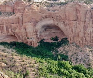
Navajo National Monument Archaeology
Navajo National Monument – Betatakin Ruin

Junior Arizona Archeologists
18 Arizona NPS sites

Click to access Junior-AZ-Arch-2016-as-published.pdf

Junior Ranger – Senior Friendly

Completed: October 18, 2018

In 2016 the Southern Arizona National Parks Office and Western National Parks Association created a statewide junior ranger program highlighting archeology throughout Arizona. The Oxford dictionary defines archeology as “the study of human history and prehistory through the excavation of sites and the analysis of artifacts and other physical remains“. Without a doubt the Arizona sites provide a wealth of experiences to explore the state’s rich archeological history.

Organ Pipe Cactus NM - Archaeology
Organ Pipe Cactus National Monument – Victoria Mine

Eighteen of the twenty-two NPS Arizona sites are included in this program. To earn the patch only four sites have to be visited. A site specific ‘rocker’ patch was initially available for all of the sites. By the time I finished it in 2018 several sites had run out of their patch. I was able to get 12 of the 18 ‘rocker’ patches. Every site I visited was friendly to this Senior.

Each site has two pages to complete, one to be done on site and another page that can be done before you arrive. To be honest I found some of these on site activities to be the hardest I have ever done. Matching the picture in the booklet with the items on display in the visitor center was a challenge. The mixture of photo identification with answering questions was a great way to learn about the site’s archeology.

Montezuma Castle NM Archaeology
Montezuma Castle National Monument

I never tire of visiting the many Arizona National Park Services sites. Having this statewide program focused on archeology provided a fun experience.

Arizona Explorer Junior Ranger


Arizona Explorer

22 Arizona NPS sites

Completed: November 20, 2018

Junior Ranger – Senior Friendly

Online;

Click to access az-explorer.pdf

Explore Arizona and earn a patch! With twenty-two National Park Service sites scattered across the state this program provides a variety of experiences. Western National Parks Association along with the National Park Service Southern Arizona Office created a state-wide Junior Ranger program. All of the sites were welcoming of this Senior Ranger.

With only four site visits and 7 pages of activities you can earn the attractive patch, with a visit to any of the sites you can earn the small site-specific ‘rocker’ patch. I was determined to visit all of the sites and get all of the rockers! Over seven months I made it to all of the sites, but the final site, Grand Canyon – Parashant National Monument eluded me. We planned to visit the monument and complete the assignment, but the office staff in St. George, UT told us no rocker was made for this site.

Now, for the best part of this program – it is based on photography! At each site there is a specific Photo Challenge. Some of the challenges involved a hike, some were right at the park’s visitor center. Rather than detail the activities in the booklet, you can view them using the link above. Below are some of the Photo Challenges I completed.

Casa Grande National Monument – Hidden Room

Chiricahua National Monument – Volcanic Hoodoos

Grand Canyon National Park – Kaibab Formation

Montezuma Castle National Monument – Historic Diorama

Glen Canyon National Recreation Area – Lee’s Ferry Peach tree

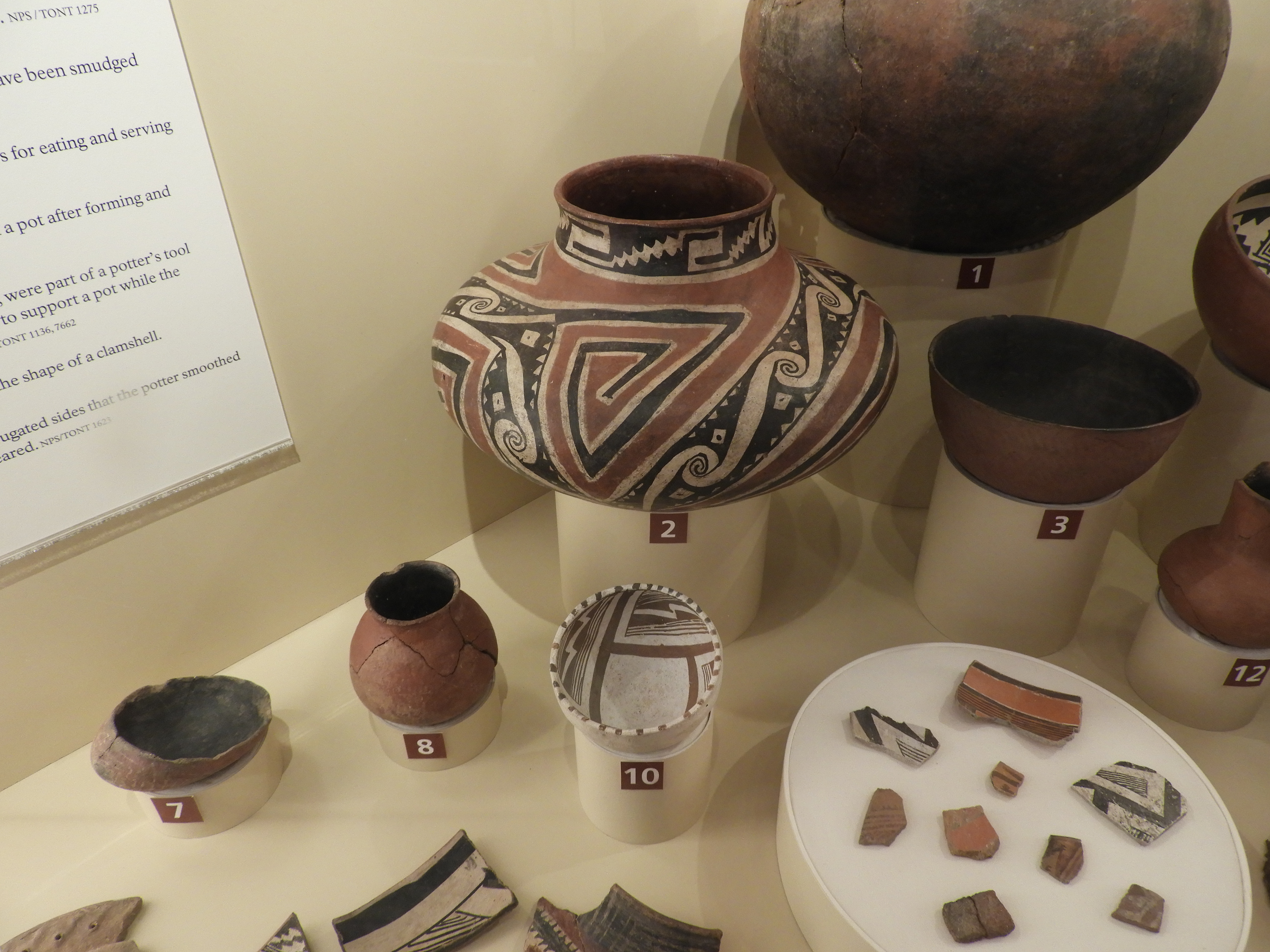
Tonto National Monument – Salado Pottery

Tonto Salado

Coronado National Monument – International Border
This hike will also qualify for their ‘I Hike for Health’ pin

Booklet

As time goes on some sites may not have the ‘rocker’ patch for their site, however the Photo Challenge and learning about the park will make this program timeless. Get Outside and Explore Arizona!

Walnut Canyon National Monument – Arizona

Walnut Canyon National Monument
Arizona

http://www.nps.gov/waca/imdex.htm

Completed: August 25, 2017

Senior Friendly

I actually completed this program in 2013 with my grandson, but misplaced the booklet and badge. I cherish the time I spent working on this with him, but wanted to have a replacement booklet and badge for this blog, so I worked on it while on my way to and from the Grand Canyon National Park this summer.

This park has ruins from 1300 CE when the Sinagua people inhabited the area. What makes these ruins unique is the ‘island’ of rock which the ruins are scattered along and many are accessible or at least easily seen from a one-mile trail which encircles the island. As this park sits at 7,000 feet and you have to walk down 185 vertical feet on stone stairs you need to carry water and be in good health. Not all of the ruins can be seen along the trail. The picture above shows some below the trail, these could be seen from a trail along the rim from the visitor center.

Three age groupings and their icon: Ages 7 and under – Horned Lizard, Ages 8 to 11 – Squirrel and Ages 12 and up – Raven. Each group is to complete the activities matching the icon showing on each page, with each group having three activities to complete.

Activities are; Trekking In and Out of the Canyon, Plant Hunter, Canyon Puzzler, A-MAZE-ing Trails, SENSE-ational Walnut Canyon, To Protect and Preserve, Park Rangers at Work, Where in the Canyon, Identify a Tree, Respect to Protect and Notes from the Edge. The last two activities are for all ages. The Raven activities are; Canyon Puzzler, To Protect and Preserve and Identify a Tree.

I always enjoy completing a crossword puzzle based on the park, much more than a word search. I always learn something from the clues. To Protect and Preserve was interesting, using a word bank, blanks are filled in to reconstruct the proclamation that established Walnut Canyon National Monument by President Woodrow Wilson in 1915. Wow, this site was established a year before the National Park Service was created from the Department of the Interior.

Identify a Tree is a great resource, besides helping me identify a Ponderosa Pine while visiting, it will help to identify other trees in the future. It uses a method of yes and no questions which create a key leading to six different trees found in this area, and throughout Arizona and the Southwest.

Ruin on rim

On the day I picked up the booklet a ceremony had just finished dedicating a plaque honoring Stephen Tyng Mather, considered the founder of the National Park Service. Not every site has a plaque, many were placed in the 1930s, again in the 1960s. The NPS Centennial in 2016 renewed interest in placing these plaques at more parks. Through private donations this plaque was installed on August 25, 2017. We missed the dedication, but enjoyed some cake. A few days later I returned with my booklet completed and received their beautiful wooden badge. This wooden badge is sturdier than other wooden badges I have received, probably not walnut, though.

Hubbell Trading Post National Historic Site – Arizona

Visitor Center

Hubbell Trading Post National Historic Site
Arizona

http://www.nps.gov/hutr/index.htm

Completed: April 8, 2017

Senior Friendly

Click to access Junior%20Ranger%20for%20Website-2.pdf

A visit to Hubbell Trading Post NHS is a step back in time, a time when this trading post would have been bustling with locals, brought by horse to trade their goods for supplies. This site has been active since 1878, and still serves the local Navajos as a place to buy goods , as well as trade or sell their crafts. You can walk into the trading post, buy some of the traditional items, such as blue cornmeal, hand-woven rugs and exquisite jewelry, as well as modern snacks and drinks. There are not a lot of buildings open to visit, without being on a tour, but the grounds are relaxing to stroll through.

The visitor center is along the road into the site and has some interesting displays. I picked up the booklet from the ranger on duty. The downloadable booklet linked above is a different booklet, it has more activities with better graphics. Both booklets only require completing four activities and neither give an upper, or lower age.

Stone Hogan

I completed all four activities; Visitor Center Facts, Matching Terms, Cross Number Puzzle and Navajo Rug. As simple as this booklet seemed to be, I have to say finding some of the answers was challenging. It caused me to read the displays very carefully. I really enjoyed the Cross Number Puzzle, using only numbers to fill in the grids was unique. Coloring the Navajo rug was fun.

It probably took about an hour to complete the booklet I received. Having to complete only four activities, also in the new booklet will probably just take an hour, as well. The ranger reviewed my answers, helped me with a few of the questions , then gave me a standard Junior Ranger badge.

Petrified Forest National Park – Arizona

Petrified Forest National Park
Arizona
http://www.nps.gov/pefo/imdex.htm

Completed: April 8, 2017

Click to access JrRangerBook2017-ndd.pdf

Senior Friendly

You won’t just find beautiful petrified wood as you explore this park, you’ll also find unique buildings, remnants of Route 66, as well as dinosaur bones. Hopefully, you can drive the entire park, south to north, or reverse. Plan to stop and explore along the way, there are great views and short hikes to enjoy.

On a prior visit I had picked up a Junior Ranger booklet and worked on it before returning for this visit. Since picking up the booklet a new, with very nice and colorful graphics, booklet was issued. As I had completed the required number of activities listed in the new booklet I was awarded the Junior Ranger badge.

This program is Senior Friendly as no upper age limit is given. The age groupings and requirements are; 6 years or younger complete at least 3 activities, ages 7 to 10 complete at 5 activities and ages 11 or older complete at least 7 activities.

The twelve activities are; Experience Your America, Wildlife Watch, Archeology, Petrified Forest Crossword, Trail Explorer, Animal Adaptations, How Old Are These Things?, When We Left Home, No Bones About It, Petrified Wood Detective, Even More Spectacular, and Jr. Ranger Field Notes. I always appreciate when there are more activities than required for the upper age group, so I can pick and choose.

A unique feature of this program are the icons that can be found on park signs that match activities in the booklet. This is a big help as you travel and stop at the many interesting places, it alerts you to find a matching activity. I hope other parks add this feature to link their Junior Ranger activities to park signs.

As usual I enjoyed Wildlife Watch, as I find being alert for the local animals and their signs keeps it interesting while you are in a park. It makes you focus on what is out there, not just the activities in the booklet. On this trip I only saw Ravens and Lizards, I hope on a future visit to see Pronghorns. No Bones About It was a great activity while visiting the Rainbow Forest Museum, at the south end of the park, and use the information displayed to answer the questions.

Petrified wood is the reason to visit this park and Petrified Wood Detective allows you to get up and personal with a piece of wood and record what it feels like and the colors in the wood. Of course, while visiting the park it is OK to touch the wood, but not to remove it. As you enter and exit the park a ranger will talk to you about leaving all petrified wood in place. But, while out hiking in the park, spend time looking and touching the wide variety of textures and colors.

While driving the tour route I finished the booklet and stopped at the Painted Desert Inn, a beautiful building constructed with petrified wood in the early 1920s. The murals painted inside the rooms are gorgeous and well worth stopping to see. The ranger on duty reviewed my booklet, gave me a copy of the new booklet, had me recite the oath and awarded me their attractive enhance badge. The badge is shiny and depicts a landscape with a rising sun with petrified wood in the foreground. So much to see, get out and explore!