El Camino del Diablo – Dec 2020

Dates: December 8-9, 2020

Vehicle: 2020 Jeep Wrangler JK, Rubicon, stock

Permit: iSportsman via https://luke.isportsman.net

Resource: A Visitor’s Guide to El Camino del Diablo (2016)

I primarily used this resource as it could be downloaded and used offline. It was a bit convoluted to follow, but once you figure out the paging it was invaluable. I found this as a .pdf at Sierraclub.org

Overnight accomodations

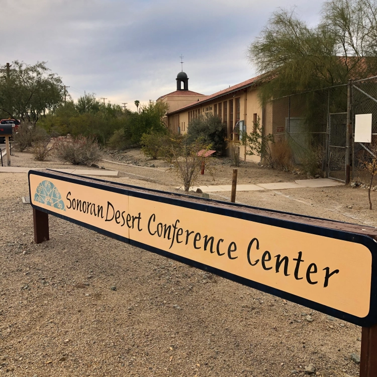
Ajo – Sonoran Desert Inn & Conference Center, highly recommended
http://www.sonorancc.com

Yuma – national motel chain 

Route:

Day 1 – Ajo to Tule Well to Wellton

Day 2 – Yuma to Tinajas Altas to Tule Well to Tacna

Day 1

  The night before we arrived in Ajo and checked into the Sonoran Desert Inn & Conference Center, a delightful place to stay. This is operated as a non-profit, in a refurbished elementary school. The rooms are very comfortable and spacious. After a comfortable night we drove out of Ajo east to Darby Well Road to start the first part of our trip, starting a bit after 9 AM. 

   After driving through the Bureau of Land Management area, which allows dispersed camping, we entered the Organ Pipe Cactus National Monument. We did see a few of the iconic Organ Pipe cactus, mainly along slopes to the east. We bypassed Bates Well, we had spent time there last Spring. Well worth a stop and time spent exploring the structures. 
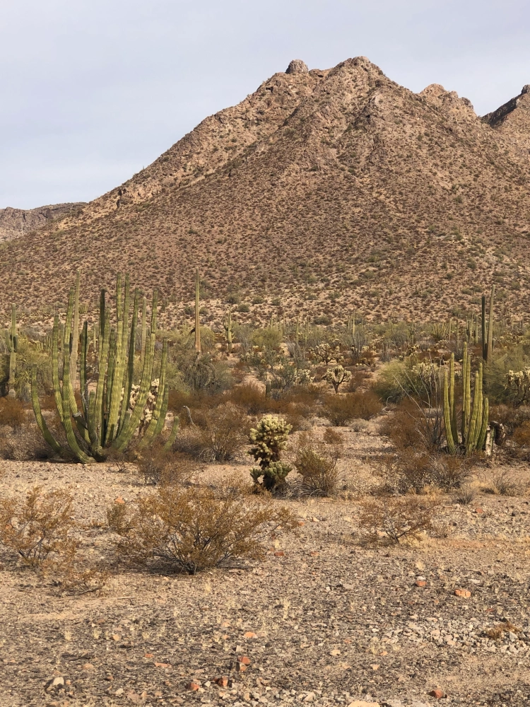
   The road so far was well-graded and suitable for any 2 WD, as it remains up to the Cabeza Prieta National Wildlife Refuge (NWR) entrance. At the entrance sign is a sign-in stand which has permits to record your trip details, this is in addition to the permit you must secure online before starting the trip. That permit is a print out which is to remain on your dashboard and provides a permit number used for the permits (one per person) at the NWR entrance. The permit at the East entrance was more detailed than the one we completed the next day at the West entrance.

  Once on the refuge the road became narrower, but still 2 WD. It wasn’t until we entered Las Playas, at mile 47 (from Darby Well Rd & AZ 85) that sand became deeper and 4 WD recommended. After any rain this section could be impassable, check with NWR staff before starting the route. A few days before they confirmed via e-mail the route was in good shape and passable in this area. The guide mentions the use of metal landing mats, we saw these off to the side of the road, never in the roadway. Shortly we entered the Pinacate Lava Flow, rough rocks, but nothing difficult to traverse, just slow down. 
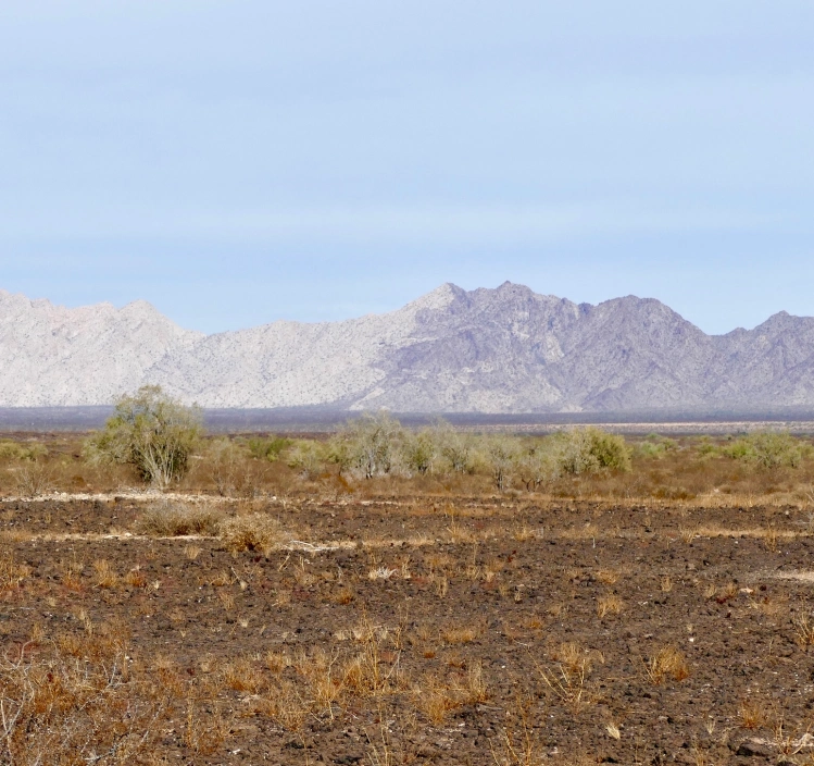
  Near mile 50, looking Northwest you notice a mountain range where a light section meets a dark section, the Sierra Pinta.  This is a geologic example of horst and graben, a fault line displaying one block up, one block down. The surrounding area also has some dramatic lava peaks. We stopped for lunch in a wash near mile 63.8. We had hoped to see bighorn sheep in the surrounding hills, but no luck.  

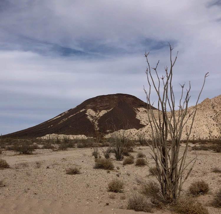
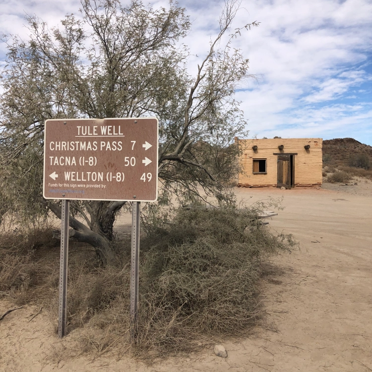
   At mile 66.8 an administrative road came in from the southeast and the road doubled in width and smoothed out. No research prepared us for this, a construction road for the Border Wall. Along with the new road came lots of large trucks and other vehicles. This continued all the way into Wellton and I-8. We stopped briefly at Tule Well to see the cabin built in 1989 by the military to commemorate the 50th anniversary of the NWR. Further along was a nice view of Tordillo Mountain.
   As we headed northwest to I-8 and left the Goldwater Military Range this sign gave the best history of El Camino del Diablo. We ended the day in Yuma, staying overnight in a motel. 

Day 2

   Starting from Yuma we went south on Foothills Blvd, entering the Western section of the Goldwater Military Range. Prior to starting I used the Visitor Guide to reverse the mileage, as the guide is written from east to west. We stayed along the pole line road, not taking the side trip to the Fortuna Mine, we’ll do that at another time. 

   After a straight shot south we turned east and began heading towards mountains. All along the southern edge of the road were signs warning us of unexploded ordnance. The best views were to the north, passing rugged hills of solid rock.

    Along this stretch we saw one stationary mobile Border Patrol truck, but no other vehicles till we reached the other side of Tinajas Altas. Wooden posts mark the way, acting as confidence markers at various intersections, as well as a few small brown signs identifying El Camino del Diablo. The only question we had was at A13, but stopping and checking the guide kept us on the best path. Along this stretch there were quite a few sandy wash crossing, more washboard than yesterday and maybe one place where high-clearance was needed. The drive approaching Tinajas Altas was interesting as you couldn’t figure out where you were headed. Once at the pass we were surprised at how wide the area was between mountains on each side. It was a nice place to take a break after about 2 hours of driving.  

   East of here we quickly reached the wide construction road which took us back to Tule Well. We stopped here for quick bite of lunch before heading north to Christmas Pass.
This route was popular over a century ago, considered to be the quickest route to reliable water along the Gila River. After driving the route I can’t imagine how they kept supplied with water along the way.  This was a beautiful section, heading through some mining claims and shapely hills. You pass remains of camp from the 1940’s. Dan Drift lived out here and fashioned the road at Christmas Pass so he could get to Wellton for supplies. The next 2 miles were where 4 WD and high clearance were necessary. We saw no one else along this section until we turned the corner at Christmas Pass and saw a group of 5 OHVs and their riders enjoying lunch at the campground. 

  From here the road was a narrow wash bed that headed north to I-8, about 37 miles. As you approached the Mohawk Dunes at mile 30 the road became wide and more solid. The views along the drive were primarily of mountains in the distance and large expanses of creosote bushes roadside. One place worth stopping was for a very large Ironwood tree, I can only imagine how beautiful it would be when blooming in the spring. 

 The sand was never a concern for driving, in fact you still felt the washboard beneath. The guide book indicated you would turn left near mile 40 to head back west before reaching the on ramp for I-8. We missed that turn and literally came up to an open gate at the shoulder of I-8. As we were heading east, back to Tucson, we carefully entered I-8 there, no signs were present to indicate no entry or exit. 

   Overall the trip was excellent, two days of mid-70 degrees and no wind made for the best weather possible to enjoy the route. As other write ups reveal there are a number of sights along the way to stop and explore. As this was our first time having a vehicle we felt comfortable driving the routes we wanted to see what was there and where we would spend more time in the future. 

   A great place to practice physical distancing during the covid pandemic. Overall we probably saw 5 Border Patrol vehicles, 2 helicopters, maybe 3 other private vehicles, the OHV group and numerous construction vehicles. Before reaching the Las Playas a Border Patrol agent chatted with us while we were out of the car exploring O’Neill’s gravesite. He warned us they were tracking 8 migrants further up the road, that is where we saw 2 helicopters close to the ground flying in tight circles. It was well north of the road and didn’t affect our route. The only surprise of the trip was the developed construction road right in the middle of El Camino del Diablo. 

   We accomplished our goal of driving the different routes and are looking forward to return trips in the future.  

Grand Staircase-Escalante National Monument – Utah


Grand Staircase – Escalante National Monument
Utah

https://www.blm.gov/programs/national-conservation-lands/utah/grand-staircase-escalante-national-monument

Junior Scientist

Completed: May 20, 2016

The beauty of this monument is incredible, expansive and memorable. Get Outside and explore this unique landscape! My few photos do not do justice to this landmass, however the diversity of this monument is well represented in the Junior Scientist Activity Booklet.

When I completed the program in 2016 this Bureau of Land Management (BLM) National Monument was much larger than it is as I write this blog. And, as I recently drove through the area I was saddened to realize this monument, which was shrunk in size in early 2018, had been reduced in areas that were previously readily accessible from major roadways . I only hope that one day, soon, the original boundaries can restored.

This program does have an upper age limit printed in the booklet, however I was provided the booklet and badge readily. To become a Junior Scientist you need to;
Watch the “Traces in Time” video, available at several of their visitor centers.
6-8 years old completes 3 or more activities, 9-12 years old completes 5 or more activities.
Activities include;
Visitor Center Scavenger Hunt, Climbing the Grand Staircase, Paleontology Tool Hunt, Creating a Landscape, Top-Toe through the Crypto, Animal Tracks, Connecting to the Past, Human History, Leave No Trace, and Journal.

The Visitor Center Scavenger Hunt can be completed by visiting the four visitor centers and identifying each center’s theme and answer one question. During this one trip I was able to visit all four sites so I was able to complete all of the activities. As an adult, if you plan to complete this program, plan to visit all four visitor centers – well worth the views along the way!

Creating a Landscape was a drawing activity to illustrate how geology, through deposition and erosion, creates different landscape. My basic sketch depicted a rain cloud over the slick rock. I enjoyed Animal Tracks which included a story with animal tracks embedded, you had to match the animal’s tracks to the animal in the story.

Besides highlighting geology and biology the booklet includes great activities to learn about cryptobiotic soil, paleontology, archeology and environmental impact. The diversity of this monument is well represented in these activities. After exploring Grand Staircase- Escalante National Monument I completed all of the activities on the Junior Scientist Activity Booklet I received the badge at the Escalante Visitor Center.

El Malpais National Monument – New Mexico

La Ventana Sandstone Arch
El Malpais National Monument – New Mexico

http://www.nps.gov/elma/index.htm

Completed: October 5, 2017

Senior Friendly

While traveling along I-40 in New Mexico a great detour to the south of Grants is a largely unknown national monument with lots to see and experience. Parts of the park are also managed by the Bureau of Land Management (BLM). From black lava flows to beautiful sandstone arches plus wildlife and wildflowers, what’s not to like!

You can pick up an El Malpais Junior Ranger book at the BLM Ranger Station (check hours), the Northwest New Mexico Visitor Center (right off I-40 in Grants), or the Information Center (closed in the winter). Once completed the booklet can be checked by a ranger at any of the three visitor centers. Or, if you can’t complete your mission while visiting, just send it in and they will send you your badge and certificate.


Rufous Hummingbird

This program is considered Senior Friendly as no age limit is given. Everyone is to complete at least six of the nine activities for all ages. Activities include; The Continental Divide, Hiking the CDT, Big Rock Bingo, Life Zones, Water Ways, Picturing People, Indoor Scavenger Hunts: BLM Ranger Station, Northwest New Mexico Visitor Center, and El Malpais Information Center, Listen Up, Down, and All Around and In Your Own Words.

One of the highlights of this part is the Continental Divide Trail (CDT), a 3,100 mile multi-use trail following the continental divide linking Mexico to Canada. This is considered the PhD of long distance trails, with the Appalachian Trail the bachelor level and the Pacific Crest Trail the masters. While visiting you can learn more about the CDT by completing the first two activities and by day-hiking sections in the park.

Snowball Sand Verbena
El Malpais is all about volcanoes, as recently as 2,000 to 3,000 years ago. Big Rock Bingo is a great activity to learn about the different kinds of formations created; spatter cone, pahoehoe flows, lava tubes, as well as other ones. As lifeless as the lava flows can seem the monument is alive with animals and plants. While camped at Joe Skeen Campground I was fortunate to see a Prairie Rattlesnake near our campsite.

Prairie Rattlesnake

Completing the Indoor Scavenger Hunt at the Northwest New Mexico Visitor Center took some patience to read the displays to answer the four questions about the Monument, staff were helpful in guiding me to the needed information. So many places within the park site are off the beaten path that you can hear the sounds of nature with fewer human-made sounds which you can record in Listen Up, Down and All Around.

I picked up the booklet on a visit in July 2017 and returned in October 2017 to finish and receive my Junior Ranger badge. This is a site I look forward to visiting again and again, hoping to see more wildlife, as well as explore this diverse environment.

Arizona Trail National Scenic Trail – BLM

image
North Kaiba Trail – Grand Canyon National Park
http://www.aztrail.org/juniorexplorer

Completed: January 19, 2016

Senior Friendly

The Arizona Trail almost runs through my backyard in Tucson, about 10 miles to the east. I have hiked short sections throughout Arizona; the whole trail is over 800 miles and reaches from Mexico to Utah. Hikers, bicyclists and horseback riders are able to cover the entire distance either as a through-trip (taking a long time) or done in sections.
image

The trail passes through private and public land; public lands managed by state and federal agencies. Some of the federal agencies are; Bureau of Land Management, US Forest Service, and Department of Interior. An important resource to enjoy the trail is the Arizona Trail Organization which can be reached at http://www.aztrail.org.

image

This program has a a very attractive handbook with excellent graphics and detailed information about what you would see along the 800 mile route. I was fortunate to find this booklet at the REI store in Tucson, however the entire handbook can be completed online. The BLM (Bureau of Land Management) provided this Junior Explorer program. It is considered Senior Friendly as no age range is given. With the information provided in the reading the material in this booklet is advanced. With adult help younger children could answer the questions and earn the patch.
image

Another unique part of this program is your answers are submitted online. Once you complete the handbook and submit the answers an attractive patch is mailed to you. I was surprised when my patch arrived within a week. I celebrated by hiking a 3-1/2 mile section, Marsh Station Road to Colossal Cave Mountain Park.
image

But before I earned my patch I had to complete the booklet. The trail for this activity begins at the southern border, the border with Mexico and works north. The page titles are; Arizona-Sonora Borderlands, Following Water: from top to bottom, The Sky Islands, Biotic Communities: along the Arizona Trail, The Gila River, Tracking Felines: on the Arizona Trail, Mogollon Rim, Cream-Filled Cookie:Plate Tectonics, San Francisco Peaks, Anatomy: of a Volcano, The Grand Canyon, Build Your Own Trail:along the Arizona Trail, The Arizona Strip, Create A Sound Map:along the Arizona Trail, Share The Trail: with other trail users!, and More Places: to Play and Learn.

Not all of your answers will be submitted online, some drawing activities are included, as well as a demonstration of Plate Tectonics which you can eat after you are done! There are a couple of charts to complete and time spent listening outside to create a sound map. Only the online answers count towards earning the patch. I found answering all of the required questions nefoe I went online worked much better than The great part about this program is you can complete anywhere, without ever setting foot along the trail. I think if you did do this program without experiencing the trail itself, you would make it a priority to visit Arizona and enjoy some portion of the trail in the future.
image

A Junior Explorer Oath on the back of the handbook provides a certificate for you to complete. And as mentioned before, your attractive patch will arrive shortly just by submitting your answers online.
image